Fariba Esfandiari darabad
Faculty of Social Sciences
Department of Physical Geography
Phone: 045-31505980
Email: fariba.darabad@gmail.com
ORCID: https://orcid.org/0000-0002-6442-7885

University of Tabriz
2006
Ph.D. in Geomorphology (ranked first)
Thesis: A Study of the Morphogenesis Systems in the Eastern Slopes of Sabalan Mountain
Azad University, Tehran
1998
Master of Arts in Geomorphology
Dissertation: The Role of Surface Water in the Agriculture of Plains in Ardabil
Azad University, Ardabil
1995
Bachelor of Arts in Geomorphology
Education
Awards
1. The first rank in the master's degree entrance examination
2. The first rank in PhD entrance examination
3. A selected article as the distinguished article by the scientific committee at the conference on water crisis and the necessity of reviving the rights of Ardabil province from Qizil Üzan river
4. Distinguished female researcher in 2013, University Of Mohaghegh Ardabili
Memberships
1. Editor-in-Chief of Ardabil Law Enforcement Quarterly, Police Command Officer of Ardabil, Office of Applied Research
2. Member of the editorial board of Ardabil Law Enforcement Quarterly, Police Command Officer of Ardabil province, Office of Applied Research
3. Member of the cultural affairs assessment unit of Mohaghegh Ardabili University
4. Member of the educational council of the University of Mohaghegh Ardabili
5. Member of the council for research and knowledge management, Ardabil Provincial Police Command
6. Member of editorial board International Journal of Earth Sciences and Environmental Planning, Tabriz University
7- The responsible director of the scientific journal Geography and Planning - Tabriz University 2019 until now
8-Scientific editor of the International Quarterly Journal of Earth Sciences and Environmental Planning
9- The editorial board of the Quarterly Journal of Geography and Regional Planning
10- Editorial Board of Geography and Planning Quarterly
11- Conference Chairman of the First International Congress of Earth, Space and Clean Energy 2014
12- Member of the editorial board of the journal Ecology of the Land - Autumn 1401 until now
Fields of Interest
Geomorphology- Hydrology-Climatology
25 - Study of factors that affect flooding in oeder to reduce natural hazards in areas in areas Yamchi Dam using by GIS- ISSN(online): 2305-0225- Journal of Middle east applied science and technology -Peer- Review Journal- - ISSUE 10(3)Vol.6,2014. www.jmeast.webs.com
24 - Assessing River Hydrological Health Before and After Dam Construction: A Quantitative Flow Regime Analysis- Iranian Journal of Science and Technology, Transactions of Civil Engineering
23 - تأثيرپذيري متغيرهاي رژيم جريان از تغييرات مؤلفههاي اقليمي بارش و دما در برخي از رودخانههاي دامنه كوهستان سبلان- مجله علوم و مهندسي آبخيزداري ايران
22 - ارزيابي مخاطرات نهشتههاي بادي دشت سيستان و تأثير آن بر مخازن حياتي چاهنيمه زابل- مجله جغرافیا و روابط انسانی
21 - ). Forecasting monthly synoptic station temperature in Sanandaj using the MLP model. 2010Journal of Iranian Geographic Society, 7(27).
20 - Effect of topography on tree species composition and volume of coarse woody debris in an Oriental beech (Fagus orientalis Lipsky) old growth forests, northern Iran- i i Forest Forest Biogeosciences and Forestry Biogeosciences and Forestry-Research Article Research Article doi: doi: 10.3832/ifor1080-00
19 - Esfandiary Darabad, F. (2014). Application of the Topsis model in environmental power analysis for urban development: A case study of Ardabil, Nir, Namin, and Sarein cities. Journal of Geography and Development, 12 (34).
18 - Study of affect factors on flooding and crisis management in Yamchi Dam using by GIS- Journal of Middle East Applied science and Technology- peer- Review Journal- ISSN( online)2305-0225- Paper ID: JMEAST-P00151562014-Date: 05/25/2014-www.jmeast.webs.com- Issue 15, Vol .6, 2014.
17 - . Esfandiary Darabad, F. (2013). Statistical decryption of the effect of global warming on the abnormalities of the Aras River basin. Quantitative Geomorphological Research, 4, 43-60.
16 - Esfandiary Darabad, F. (2012). Landslide zonation in Pave-Nodasheh road using AHP and Expert choice in GIS environment. Quantitative Geomorphological Research, 2, 145-158.
15 - A study of Geomorphologic factors restricting the expansion of Ardebil city using analytical hierarchy process(AHP)- Environment Conservation Journal(ISSN 0972-3099)-Action for sustainable, Efficacious Development and Awareness Malviya Marg,Rishikesh-24920,U.A.,INDIA
14 - Physico- chemical parameters and environmental pollution in the Aghlaghan chie river of Ardabil province in Iran- Environment conservation Journal ( 11 &2)17-19, 2010( ISSN 0972-3099)
13 - A study of Geomorphologic factors restricting the expansion of Ardebil city using analytical hierarchy process(AHP)- Environment Conservation Journal(ISSN 0972-3099)-Action for sustainable, Efficacious Development and Awareness Malviya Marg,Rishikesh-24920,U.A.,INDIA
12 - An investigation of toxins in plant pests and chemical fertilizers in environmental soil pollution. Conference proceedings, National Conference on Geology and Environment, Azad University, Tehran, February, 2009.(in Persian)
11 - Esfandiary Darabad, F. (2009). Statistical analysis of snowy days of Tabriz city and its relationship with the large-scale phenomenon of atmospheric-oceanic circulation of North Atlantic oscillation (NAO). Journal of Applied Geographical Sciences, 10(13).
10 - A study of the Effects of Climatic Parameters on Determining land Area for the cultivation of Canola in Ardabil Province using GIS- Research Journal of Biological Sciences 4(1 ): 1165-1168, , 2009, ISSN: 1815-8846- Medwell Journals 2009
9 - Geomorphological evidences about climate changes of upper Pleistocene in Eastern slope of Sabalan, Journal of physical Geography, Azad university of Larestan, Vo1. 1, No. 3, Spring 2009. (inpersian)
8 - - zonation of potential Risk of Rockslides in the Alvares Road using GIS. Research Journal of Applied sciences 4(6): 221-224, 2009- ISSN: 1sarein1815-932X Medwell Journals, 2009.
7 - Climatic abnormality and human safety: A case study on Ardabil province. International Conference on Human Safety in Western Asia, Birjand University, November, 2008.(in Persian)
6 - Modelling of erosion of deposits and production of sediments in Nooran water sheds using Psiak method and GIS. National Conference on Geomorphological Studies in Environment Optimization and Management. Azad University, Tehran, October, 2008.(in Persian)
5 - - Landslide Hazard Zonation of Ardabil-Astara highway using GIS. Quarterly Geomorphological Journal of Territory, Vol 5, No. 18, 2008.(in Persian)
4 - A study of nivation processes and its geomorphic effects on the Eastern slopes of Sabalan. Pazhuheshhaye Geographiayi, Tehran University, No. 61; 2007.(in Persian)
3 - Landslide Hazard Zonation in the Sardabe Region. Conference on Geography and the 21st Century. Journal of Azad University, Najafabad, Esfahan, May, 2006.(in Persian) A Study of periglacial processes and landforms in the eastern slopes of Sabalan. Iranian Journal of Geography and Development, University of Sistan and Baluchestan, No. 7, 2006.(in Persian)
2 - A Study of periglacial processes and landforms in the eastern slopes of Sabalan. Iranian Journal of Geography and Development, University of Sistan and Baluchestan, No. 7, 2006.(in Persian)
1 - Geomorphometry of Barzand watersheds. Scientific Conference on Geography, Azad University, Astara, May, 2003.(in Persian)
2. Director of the Department of Natural Geography from 2014 to date
3- Vice-Chancellor of the Faculty of Social Sciences since 1400-1401
برنامه هفتگی استاد در ترم جاری
| نام درس | مقطع | زمان و مکان ارائه |
|---|---|---|
| ارزيابي توان اكولوژيك در طبيعت گردي | کارشناسی ارشد |
شنبه - کلاس 5 - 14-16 |
| مديريت مناطق كارستي | کارشناسی ارشد |
دوشنبه - آزمایشگاه جغرافیا - 14-16 |
| ژئومورفولوژی کمی رودخانه ای | کارشناسی |
شنبه - کلاس5 - 12-14 |
| ژئومورفولوژی شهری | کارشناسی |
دوشنبه - آ - 14-16 |
| مخاطرات محیطی | کارشناسی |
شنبه - کلاس17 - 14-16 |
| سیاست گذاری و برنامه ریزی اکوتوریسم اجتماعی محور | کارشناسی ارشد |
شنبه - کلاس 13 - 16-18 |
| تهیه نقشه های ژئومورفولوژی کاربردی | کارشناسی ارشد |
یکشنبه - کلاس رایانه - 14-16 |
| تکنیکهای تحلیل مخاطرات شهری | دکتری |
یکشنبه - کلاس9 - 16-18 |
| مخاطرات ژئومورفولوژی | کارشناسی ارشد |
دوشنبه - کلاس13 - 14-16 |
| مدیریت پروژه برای کاهش مخاطرات محیطی | کارشناسی ارشد |
دوشنبه - کلاس13 - 16-18 |
13 - Assessing the impact of land use changes in the Firuzabad Basin on erosion and sedimentation rates over the past 30 years, Elhame Ebadi ,
12 - Estimation of suspended sediment in Abriz Qaresu basin of Ardabil province using statistical techniques of artificial neural network and remote sensing., Ehsan ghale , 2024
11 - Analyzing the effects of encroachment on the sanctity of the river and changes in land use in the morphology and flooding of the Kohman River , Iman Belvasi, 2019
10 - Investigating the geomorphological and neo-tectonic evidences with an emphasis on the seismicity of faults and the hazards caused by them, a case study: Nemin Astara and Talesh , Vida Irani , 2021
9 - Modeling the changes of erosion and sedimentation of Sejasroud river before and after the construction of Glaber dam with GCD method and analysis of river bed changes , Hassan Mozafari , 2021
8 - Quantitative analysis of changes in the channel of the Aort river using morphometric methods (study area: downstream of the Mhadan dam to Aras river, Arslan Mehrovarz , 2023
7 - Assessing the risks of wind deposits in the Sistan plain and its impact on the vital reservoirs of the semi-zabul well - Mehdi Jadidal Islami - PhD student - summer 1402, Mehdi Jadidal Islami , 2023
6 - - Evaluation of the effects of land use changes on the morphology of Dareh Rood River in a period of 30 years (1990-2019) - Rasul Hassanzadeh - Ph.D. student - Fall 1400, Rasul Hassanzadeh , 2021
5 - The effects of vegetation change on the diversity and formation of geomorphic forms (Case study: Khairud forest next to Nowshahr, Mazandaran - Samira Shekarbahjati - Ph.D. student - Winter 2018, Samira Shekarbahjati , 2018
4 - -Evaluation of the impact of natural and human factors on the qualitative and morphological characteristics of the riverbed (case study: Taleghan River) - Doctoral student - Mrs. Nazila Yagoubnejad Asl - Summer 2018, Mrs. Nazila Yagoubnejad Asl , 2018
3 - Extraction and characterization of landforms using multi-scale and object-oriented analysis, a case study of the northern slopes of Sablan - Mr. Ebrahim Beheshti Javed - PhD student - Winter 2017., Mr. Ebrahim Beheshti Javed , 2017
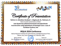
2 - Reconstructing the ancient environments of western Kurdistan using rock caves and glacial landforms in the Late Quaternary. Mr. Omid Rahimi - PhD student - summer 2017., Mr. Omid Rahimi , 2017
1 - Investigating the role of geomorphological parameters in the distribution of vegetation in Arsbaran watersheds (case study: Napeshte Chai, Ilgineh Chai and Mardanqum Chai) - Mr. Morteza Karachorlo - Ph.D. student - 14 February 2016, Mr. Morteza Karachorlo , 2016
Master
101 - Potential assessment of ecotourism and geotourism capabilities of Ardabil province using quantitative models: case study of Fandoglou forests, Darband Vargeh Saran, Lake Soha, Bulaghlar Nir and Shahriri, Solmaz Bahrami Bodalalu,
100 - Landslide risk assessment in the Zamkan watershed in Kermanshah province using quantitative approaches (catastrophe theory, logistic regression, and support vector machines), Ghobad Rostami,
99 - Zoning of domain risks on Meshginshahr-Ahar road using artificial neural network system, omid zakizadeh , 2024
98 - Zoning of domain risks on Khalkhal to Shahroud road using artificial neural network system, mehrdad vahabzadeh , 2024
97 - A geomorphological study of Gamasiab basin with an emphasis on Karstic forms, Kobra Kiyani, 2015
96 - Analytical and synoptic analysis of early and late freezing in Kurdistan province, Sanya Karami, 2016
95 - A study on morphogenetic-morphodynamic and environmental hazards of the Karganroud basin using GIS in Talesh,, Roghayyeh Fathi, 2016
94 - Determining bioclimatic indices of Meshkin Shahr city, , Ebrahim Arami, 2015
93 - Statistical and synoptic analysis of agricultural drought in Germi province to provide solutions to reduce damage, Malek Lotfi Zarenji, 2016
92 - Modeling of soil erosion and sediment production in Zal river basin using modified Psiak method and GIS, , Shahram Nikpour, 2016
91 - An analysis of environmental hazards and geomorphology of rural settlements in Bazargan plain with an emphasis on amplitude motions, , Hamideh Zainalpour, 2015
90 - Feasibility study on tourism development in Nir,, Rawiyeh Azizzadeh, 2015
89 - . Investigating the climatic factors in tourism of Sardabeh by SWOT analysis,, Shahbaz Nordarkokshan, 2016
88 - Analysis of bioclimatic indices of Sarab and its role in environmental planning,, Manouchehr Dindar, 2015
87 - Evaluation of environmental potential of sugar beet planting based on identification of climatic elements: A case study of East Azarbaijan province,, Batool Tabatabai, 2015
86 - Challenges of tourism in Sarein city in 1404 prospect, , Behzad Khoshzad, 2016
85 - morphological features of Khiav Chay basin with an emphasis on domain processes,, Azam Saat, 2016
84 - . Investigating the capacities, obstacles, and strategies for the development of health tourism in Ardabil province with an emphasis on spas, , Gader Taghizadeh, 2017
83 - Comparative assessment of tourism and regional potential with an emphasis on geotourism using the dynamic model of a case study: Shorabil Lake, Sardabe Waterfall and Shirvan Dareh Si, hosein tavakkoly, 2018
82 - Investigating the geotourism potential of Izeh city using the Pralong model, Amin zandi, 2017
81 - Evaluation of neotectonic activities based on tectonic indicators and geomorphological evidence, rasol hasanzadeh , 2014
80 - Determining areas of possible subsidence of Ravansar Sanjabi plain using GIS and AHP, , Ali Khan Beigi,, 2015
79 - Evaluation of the current user suitability with land capacity in the Aghlaghan Chay of Nir basin based on the principles of land ecological capacity assessment, , Elham Soltani, 2015
78 - . Estimation of erosion and sediment production in Damdel Chay basin based on modified PSYAKC model, Elham Shahidi, 2015
77 - Flood zoning of Qara Sou basin from industrial town 2 to Samiyan bridge, , Parvaneh Hasanzadeh,, 2017
76 - A study of the causes of landslide occurrence in Dohezar region of Tonekabon, , Motem Ghasemi,, 2015
75 - Investigating the occurrence of flood zoning in Masouleh-Roodkhan basin,, Mozhgan Dezhagah,, 2016
74 - - Zoning of soil erosion in the Alazarchay watershed using the Psiak model , Afshin Panahi , 2021
73 - Investigating the geomorphology of the Gesht Rudkhan watershed with an emphasis on environmental hazards , Javad Nouri, 2021
72 - Identification and monitoring of landslides using radar interferometric techniques and sbas algorithm (the study area of the communication road between Nair and Sarab, Sain Pass) , Maryam Dargahi, 2021
71 - Identification and monitoring of domain instability of the Nirchai river basin using radar interferometric technique , Mozhegan Jame, 2021
70 - Estimating snow depth using radar interferometric method and calculating the resulting water in the Liqvan catchment area, Shiva Safari, 2021
69 - Investigating soil moisture in Ardabil using remote sensing techniques , Elham Melanuri , 2021
68 - Investigating and modeling the process of changes in the gardens of Lake Urmia during the past 30 years - , Mohammad Alipour Fathali Hakemabadi , 2021
67 - Evaluating the competitiveness of geotourism destinations using the pavlova model (study: Meshkinshahr city) , Parinaz Shirzadeh , 2022
66 - Determination of river flow changes using Flow Health software in some perennial rivers of Ardabil province - , Zahra Shahbazi Sharfa, 2021
65 - Analyzing the lateral changes of Aras river channel in Ardabil province using morphological indicators , Mehdi Gonadi Asl , 2021
64 - Evaluation and Zoning of Erosion Potential of Watersheds Using Geomorphometric and GIS Indicators Study of Meshkin Chai Watershed , Mahia Yensari , 2021
63 - Flood risk zoning using the HeRac hydrodynamic model, a case study of Qarasu watershed, Kermanshah province, Nazanin Fakheripur,, Nazanin Fakheripur, 2021
62 - Donya Parsha, Geomorphological analysis of Khiauchai river channel in Mishkin Shahr using Rozgen model - , 2020
61 - Change of flood flow regime and water scarcity in the rivers of Sablan range in a period of 40 years, Masoumeh Gholizadeh, 2020
60 - Modeling the effect of land use changes on flood hourly hydrograph features using remote sensing and hydrological model (Fandalo forest area) , Zainab Pourganji , 2020
59 - Landslide Zoning and Identifying Effective Factors in the Kabir River Catchment Area of Mazandaran , Mehtab Ahmadi , 2020
58 - ng stations of Ardabil province , Reza Ahani , 2020
57 - Investigating the effects of land use change on the amount of soil erosion in Zarineh River watershed , Hadi Rafiei , 2020
56 - Comparing the components of intensity, duration and frequency of river flow drought events using the SDI index under the influence of the construction of Yamchi and Sablan dams in Ardabil , Fatemeh Karimi, 2019
55 - Evaluating the impact of dam construction on the amount of suspended sediment in the stream and the features of the sediment gauge curve , Nastern Javid, 2019
54 - Flood zoning of Kashkan watershed using ANP method , Sara Sattari , 2019
53 - Integration of vegetation cover and soil looseness indicators to estimate soil erosion in the Amuqin watershed using the RUSLE model , Amir Hossam Pasban , 2019
52 - Modeling the amount of suspended sediments in the watersheds of Ardabil province using principal component analysis and multiple regression, Behrouz Nazaft , 2019
51 - Geomorphological analysis of Abbas Abad river channel (Hamadan) using hierarchical model Rozgen , -Zahra Mahdavi-, 2018
50 - Geomorphological analysis of the Hamza Khanlu river channel using the Rozgen model of the studied area from Ini Alia village to Tepebashi village , Rasul Bakhshandeh , 2018
49 - Geomorphological analysis of the Balkhlochai river channel using the Rozgen model of the studied area from Rezaluqshlaghi village to Sham Esbi , Dariush Rezaghi , 2018
48 - Analysis of the morphological changes of the Aji Chai river channel from Arzanaq to Khajeh using GIS and RS techniques -, Asadullah Bagheri , 2018
47 - Evaluation of temporal changes in vegetation characteristics of riverside communities and its role in the changes of Qarasu river channels in Ardabil province -, Mahnaz Hamzei, 2018
46 - Evaluation and Potentiometric Analysis of Geotouristic Landforms in Sabalan's Northern Range Using the Comansko Model, , Hadis Majd,, 2019
45 - The effect of flow and vegetation characteristics on the morphometry of Qara Su river: A case study of Dolatabad village to Samiyan bridge, ahmad naseri , 2018
44 - A comparison of hydrological changes of river flows by dam construction: A case study of Yamchi and Sabalan dams of Ardabil province,, leila mohammadi rad , 2018
43 - Comparative assessment of tourism and regional potential with an emphasis on geotourism using a dynamic model. Case study: Shorabil lake, Sardabe waterfall and Shirvan Dareh Si, hosein tavakkoli, 2018
42 - Investigating the changes of flood hydrological indicators under the effect of dam construction using flow continuity curves in the rivers south of Lake Urmia, reza shahmoradi , 2017
41 - Evaluation of surface and underground water resources of Hir region and selection of appropriate cultivation pattern in line with optimal water consumption, kobra azimi, 2017
40 - - Investigating the geotourism capabilities of Nair city geomorphosites using the Comanesco method, reza ghahremani , 2017
39 - Investigating the geotourism potential of Izeh city using the Pralong model., amin zandi , 2017
38 - Morphological analysis of Aras River channel during the last 25 years using the transect method of the study area: Khodaafrin Dam to Mil Moghan Dam, mohsen rahimi, 2017
37 - Analysis of Tamr river basin with emphasis on suspended sediment load data analysis, samaneh rahimi, 2016
36 - Evaluation of neotectonic activities based on tectonic indicators and geomorphological evidence in Borujerd city, esmaeil kakavand , 2017
35 - Analysis of the pattern of monthly discharge and sediment changes in a number of rivers in West Azerbaijan - Pirouzeh Feghzadeh -, piroze feghh zadeh, 2016
34 - Investigating the quantitative and qualitative changes of underground water resources of Borujen plain using geostatistical methods, raziyr ghorbani , 2016
33 - Analysis of factors affecting the formation and development of ditch erosion, a case study of Salas Babajani city, chiman veisi , 2015
32 - Modeling the vulnerability coefficient of cities against earthquakes using GIS, a case study of the city of Garami, tohid mosapoor , 2015
31 - Investigating changes in the level of underground water in Tabriz plain using geostatistical methods, elhame ebady, 2015
30 - Flood risk zoning in Balikhali Chai basin, using ANP method, a case study upstream of Yamchi dam, msoayeh parastar , 2014
29 - Evaluation of flood zoning of Ajarlocha by LTHIA method, gholamrexa poormorteza, 2014
28 - Flood risk zoning in Noran Chai catchment area using ANP model, mina shokrpoor , 2014
27 - Flood risk zoning of Kerganrood watershed using CN model, mojdeh esmaeili shekardasht, 2014
26 - 1- The role of geomorphological factors in the development of the tourism industry in North Vilkij region using the GIS geographic information system, esmaei seddigh dolat abad , 2014
25 - Khiauchai flood zoning by CN method, zahra samadi, 2014
24 - Evaluation and zoning of domain contours in the Barkili River watershed of Lahijan using LIM method, madineh babaei , 2013
23 - A research on geomorphological bottlenecks in the physical development of Ivan Gharb city with weighted integration model, masomeh zamani, 2013
22 - Evaluating the geomorphotouristic potential of landforms based on the Prolong method - a case study of Kermanshah province, hoshang abbasi, 2013
21 - Investigating the way of evolution and change of the patterns of the Maroon river and its influencing factors, abotaleb shahbazi, 2013
20 - Evaluation of road safety with the approach of environmental hazards of Khalkhal-Puna axis, gholamreza gholmoradi , 2013
19 - Analysis of artificial network performance in Nooran watershed, zahra mohammadi soltanabad , 2013
18 - Analyzing the performance of artificial neural network with regression models, azam heidari , 2013
17 - Estimating sedimentation of Aladizgeh catchment using web model, asgar jesarati , 2013
16 - Examining and analyzing the physical development scenarios of the city and the expected consequences, asaf ashofteh , 2012
15 - Investigating the capabilities and bottlenecks of geotourism industry development in Azarshahr region using SWOT model, monireh balazadeh ghazi , 2012
14 - Investigating the geomorphotourism capabilities of Kermanshah using the SWOT model, َaghdas kazemi, 2012
13 - Investigating and analyzing the effects of transportation on land use changes and selecting the appropriate scenario using the TELUM model, fakhroddin minapoor, 2012
12 - Investigating developmental constraints caused by natural and human factors in Germi city using GIS, , Soghra Jeddi, 2012
11 - Landslide hazard potential zoning in Siahroud basin (Rahmatabad-Roudbar region) using GIS, , Hossein Amirinezhad, 2012
10 - An evaluation of geotourism potentials of Neyriz city using SWOT-based model, Fatemeh Akhati, Fatemeh Akhati, 2012
9 - Evaluation and zoning of domain movements in Meshkinshahr-Mouil path using the Analytic Hierarchical Analysis Model,, Zeinab Bidar, 2012
8 - Risk instability evaluation of Paveh-Nodsheh path with an emphasis on slide and downfall using GIS, , Eghbal Hashemi, 2012
7 - Modeling the vulnerability index of cities to earthquakes using genetic algorithm and GIS: A case study in Ardebil,, Khodad Lotfi, 2013
6 - Investigating geotourism potentials of Kalibar city and its role in the development of the region, , Changiz Karimi Aeshlou, 2011
5 - . A study of geomorphologic and climatic hazards in the Shiraz-Assalouye path with an emphasis on domain movements for pre-crisis prevention management, , Mohammad Reza Nourizadeh, 2011
4 - Investigating limitations of geomorphologic processes in the development of Khorramabad province,, Mehri Taheri Chegeni, 2010
3 - Investigation and analysis of flood in Karganroud River basin,, Roham Heydarnejad,
2 - Evaluation of hydrograph model in geomorphologic unit in Gonbad Moarref basin (Hamadan), , Mehdi Behroozi,
1 - Modeling surface erosion formations and sediment production in the Hana dam basin using the modified Psiyak method and Geographic Information Systems (GIS), , Mohammad Ghasemi,